Search
(+)
cartoon
dealer
buy stock illustrations
Home
My rookie portfolio
📷 Upload yours 🤳
Find results that contain
all
of your keywords. Content filter is
on
. Search will return
best illustrations, stock vectors and clipart
.
Exclude
Make it so!
You have chosen to exclude "
" from your results.
Choose orientation:
Explore cartoons & images using related keywords:
administrative
africa
african
algeria
atlas
background
border
brown
cartography
clipping
color
countries
country
detailed
division
divisions
emblem
english
flag
geography
geology
gis
graphic
green
grunge
highlighted
infographic
isolated
line
location
map
maps
multicolor
nation
national
old
path
political
province
region
regions
republic
rest
sea
shape
showing
sign
state
symbol
territorial
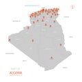
Algeria Map Showing Country Highlighted In Green Color With Rest Of African Countries In Brown Stock Photography
Download
Designed by
Marianrocky
Title
Algeria map showing country highlighted in green color with rest of African countries in brown #216454730
Description
Algeria map showing country highlighted in green color with rest of African countries in brown.
Teacher showing map of algeria on blackboard
Stylized vector Algeria map
Algeria map in 3D. 3d map with borders of regions.
Map showing Algiers,Algeria on the world map.
Algeria map in Africa, icons showing Algeria location and flags
Algeria map in Africa zoom version, icons showing Algeria location and flags
World map in perspective showing the location of the country Algeria with detailed map with flag of Algeria
Magnifying glass showing a map of Algeria on a world map
Abstract map of Algeria
Map of Algeria showing familiy diversity with colorful gender icons
Map of Algeria showing the area of the country with a pattern of black circles
View of the earth from space showing the location of Algeria
View of the earth globe from space showing Algeria in the center of the image.