Search
(+)
cartoon
dealer
buy stock illustrations
Home
Black Friday
Find results that contain
all
of your keywords. Content filter is
on
. Search will return
best illustrations, stock vectors and clipart
.
Exclude
Make it so!
You have chosen to exclude "
" from your results.
Choose orientation:
Explore cartoons & images using related keywords:
abstract
administrative
background
border
cartography
chart
chhattisgarh
concept
contour
country
delhi
design
detailed
district
division
geography
government
graphic
icons
illustration
india
indian
infographic
isolated
kerala
land
location
map
mapping
nation
national
odisha
outline
political
province
region
shape
state
symbol
territory
travel
union
uttarakhand
vector
white
world
Chhattisgarh Map. Showing State Boundary And District Boundary Of Chhattisgarh. Political And Administrative Colorful Map Of Chhat Vector Illustration
Download
Designed by
Sujataj0999
Title
Chhattisgarh map. Showing State boundary and district boundary of Chhattisgarh. Political and administrative colorful map of Chhat #218734592
Description
Chhattisgarh map. Showing State boundary and district boundary of Chhattisgarh. Political and administrative colorful map of Chhattisgarh
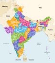
Map of India with neighbouring countries and territories. Indian map colored by states and showing districts boundaries inside eac
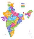
India high detailed vector map showing states and districts boundaries with states` names and capitals. Flag of India
Chhattisgarh map. Showing State boundary and district boundary of Chhattisgarh. Political and administrative colorful map of Chhat
Map of the State Chhattisgarh (IN).