Search
(+)
cartoon
dealer
buy stock illustrations
Home
Black Friday
Find results that contain
all
of your keywords. Content filter is
on
. Search will return
best illustrations, stock vectors and clipart
.
Exclude
Make it so!
You have chosen to exclude "
" from your results.
Choose orientation:
Explore cartoons & images using related keywords:
app
asphalt
blank
bologna
borders
car
cartography
city
cityscape
community
construction
curve
cut
dark
data
design
destinations
direction
district
districts
document
donatosan
equipment
geography
global
government
gray
highway
house
icon
illustration
industry
infographic
italy
journey
land
landscape
map
mobile
mountain
navigational
negative
neighbourhood
outline
pastel
patriotism
people
physical
plan
planning
White Tagged Districts Map Of Bologna, Italy Vector Illustration
Download
Designed by
Momcilojovanov
Title
White tagged districts map of Bologna, Italy #230451218
Description
Simple white vector map with black borders and name tags of urban city districts of Bologna, Italy
White tagged districts map of the city of Palma, Spain
White tagged districts map of Las Palmas, Spain
White tagged districts map of Bilbao, Spain
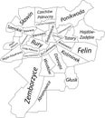
White tagged districts map of Lublin, Poland
White tagged districts map of Amsterdam, Netherlands
White tagged districts map of Biel-Bienne, Switzerland
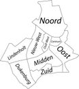
White tagged districts map of NIJMEGEN, NETHERLANDS
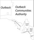
White tagged map of regions of SOUTH AUSTRALIA
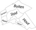
White tagged districts map of `S-HERTOGENBOSCH, NETHERLANDS
White tagged raions map of ZAPORIZHZHIA, UKRAINE
White tagged map of raions of the ZAKARPATTIA OBLAST, UKRAINE
White tagged districts map of REYKJAVIK, ICELAND
White tagged boroughs map of MÃâNCHENGLADBACH, GERMANY
White tagged districts map of MÃâNCHENGLADBACH, GERMANY
White tagged districts map of LUDWIGSHAFEN AM RHEIN, GERMANY