Search
(+)
cartoon
dealer
buy stock illustrations
Home
My rookie portfolio
📷 Upload yours 🤳
Find results that contain
all
of your keywords. Content filter is
on
. Search will return
best illustrations, stock vectors and clipart
.
Exclude
Make it so!
You have chosen to exclude "
" from your results.
Choose orientation:
Explore cartoons & images using related keywords:
japan
vector
map
illustration
hokkaido
asia
country
japanese
kyushu
okinawa
border
tokyo
geography
design
region
shikoku
hiroshima
prefecture
island
state
cartography
administrative
territory
division
osaka
province
prefectures
kyoto
chubu
nagasaki
chugoku
kanto
simple
simplified
topography
political
fukushima
fukuoka
honshu
borderline
regions
blank
clear
black
outline
thin
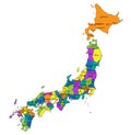
Japan - Political Map Of Regions Cartoon Vector
Download
Designed by
Pytyczech
Title
Japan - political map of regions #231952933
Description
Political map of Japan. Administrative divisions - regions. Simple flat blank vector map
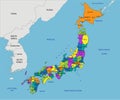
Japan Political Map
Colorful Japan political map with clearly labeled, separated layers.
Japan political map of administrative divisions
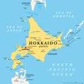
Hokkaido, second largest island of Japan, political map
Japan political map of administrative divisions
Nanpo Islands, volcanic island groups of Japan, political map
Izu Islands, volcanic island group of Japan, political map
Volcano Islands, also Iwo Islands, volcanic island group of Japan, political map
Tumen river flowing on Noktundo into Sea of Japan, political map
Kansai region, or the Kinki region in Japan, political map
Kyushu island and nregion in Japan, political map with prefectures
Osaka Prefecture of Japan, political map
Kyoto Prefecture of Japan, political map
Kanto region of Japan, political map