Search
(+)
cartoon
dealer
buy stock illustrations
Home
My rookie portfolio
📷 Upload yours 🤳
Find results that contain
all
of your keywords. Content filter is
on
. Search will return
best illustrations, stock vectors and clipart
.
Exclude
Make it so!
You have chosen to exclude "
" from your results.
Choose orientation:
Explore cartoons & images using related keywords:
africa
america
argetina
atlas
australia
background
belgium
black
brazil
business
canada
canvas
caraiben
chile
china
collection
country
design
education
element
europe
france
germany
global
holiday
illustration
info
information
isolated
japan
map
mongolia
north
object
render
school
set
south
spain
states
travel
united
vietnam
wales
white
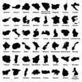
A Illustration Of All Maps From The World A - L
Download
Designed by
Gringos4
Title
A illustration of all maps from the world A - L #23431701
Description
A 3d illustration of all maps from the world A - L
United States Map
Big vector set of all Europe states, countries on white background. High detailed editable illustration of Europe maps.
Map icon vector illustration, maps pin sign
Terrain map. Contours trails, image grid geographic relief topographic contour line maps cartography texture, vector
Low poly GPS pin on pc laptop screen. Maps and navigator services.
Pandemic virus corona disaster attacked country germany illustration
Pandemic virus corona disaster attacked country indonesia illustration
India attacked corona virus lockdown vector illustration
Virus corona disaster attacked iran country illustration
India attacked corona virus lockdown vector illustration
Vector illustration - maps flat design mobile info character people young couple template design , navigation on phone gps
Illustration Maps Indonesia lockdown covid-19 pandemic with white background
Flat illustration maps design vector
Folder icon and distance. Distance illustration.