Search
(+)
cartoon
dealer
buy stock illustrations
Home
My rookie portfolio
📷 Upload yours 🤳
Find results that contain
all
of your keywords. Content filter is
on
. Search will return
best illustrations, stock vectors and clipart
.
Exclude
Make it so!
You have chosen to exclude "
" from your results.
Choose orientation:
Explore cartoons & images using related keywords:
abstract
america
background
cartography
county
design
destinations
federal
geography
globe
graphic
guidance
illustration
image
isolated
journey
lake
location
locations
macro
map
north
outline
provo
rendering
salt
silhouette
state
states
symbol
thumbtack
topographical
tourism
transport
travel
united
usa
utah
vector
white
yellow
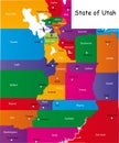
Utah Map. District Map Of Utah In District Map Of Utah. Color With Capital Vector Illustration
Download
Designed by
Sujataj0999
Title
Utah Map. District map of Utah in District map of Utah. color with capital #235745484
Description
Utah Map. District map of Utah in District map of Utah. color with capital design
State of Utah
State of Utah
Map of Utah state
State of Utah, USA
Grunge rubber stamp or label with text Provo, Utah
Vector posters with highly detailed silhouettes of maps of the states of America, Division Mountain - Nevada, Utah, Arizona - set
Vector posters states of the United States with a name, nickname, date admitted to the Union, Division Mountain - Nevada, Utah,
Utah Map. State and district map of Utah. Political map of Utah with the major district
Utah Map. State and district map of Utah. Political map of Utah with neighboring countries and borders
Utah Map. State and district map of Utah. Administrative map of Utah with district and capital in white color
Utah Map. State and district map of Utah. Political map of Utah with outline and black and white design
Sunset District San Francisco Vintage Poster Postcard
Utah counties map and at-large congressional district map. Salt Lake City skyline
Utah, U.S. state, subdivided into 29 counties, multi colored map