Find results that contain all of your keywords. Content filter is on.
Search will return best illustrations, stock vectors and clipart.
Choose orientation:
Make it so!
You have chosen to exclude "" from your results.
Choose orientation:
Explore cartoons & images using related keywords:
2010
ancient
antique
antiquities
archaeological
architecture
art
attraction august basilica biblical byzantine can cartographic cartography cathedral century christian christianity church crusades decoration east famous floor george history holy inside jerusalem jordan land locations madaba map maps mosaic museum old oldest ornamental orthodox palestine palestinian religion representation saint seen sixth skyMap Of The Crusades Of The Sixth Century In Which The Oldest Cartographic Representation Of The Holy Land In History Editorial Image
Designed by
Title
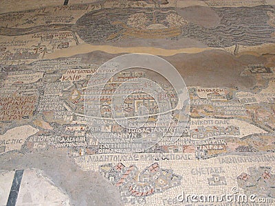
Map of the crusades of the sixth century in which the oldest cartographic representation of the Holy Land in history #240772700
Description
Madaba, Jordan, August 9, 2010: Map of the crusades of the sixth century in which the oldest cartographic representation of the Holy Land in history can be seen inside the orthodox church of Saint George in Madaba, Jordan
This image is editorial

