Search
(+)
cartoon
dealer
buy stock illustrations
Home
My rookie portfolio
📷 Upload yours 🤳
Find results that contain
all
of your keywords. Content filter is
on
. Search will return
best illustrations, stock vectors and clipart
.
Exclude
Make it so!
You have chosen to exclude "
" from your results.
Choose orientation:
Explore cartoons & images using related keywords:
brazil
states
municipalities
detailed
vector
map
colored
regions
america
center
country
flag
geography
illustration
midwest
north
northeast
region
south
southeast
travel
trip
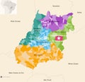
Brazil States And Municipalities Detailed Vector Map Colored By Regions
Download
Designed by
Jktu21
Title
Brazil states and municipalities detailed vector map colored by regions #252167339
Description
Brazil states and municipalities detailed vector map colored by regions.
Brazil States Flag Collection Vector Illustration in Official Colors And Proportion
United States of America vs Brazil, Brazilian smoky mystic flags placed side by side. Thick colored silky smoke flags of America
Brazil states - Amapa smoky mystical flag on the old dirty wall background
Brazil states - Distrito Federal smoky mystical flag on the old dirty wall background
Brazil states - Goias smoky mystical flag on the old dirty wall background
Brazil states - Minas Gerais smoky mystical flag on the old dirty wall background
Brazil states - Para smoky mystical flag on the old dirty wall background
Brazil states - Mato Grosso smoky mystical flag on the old dirty wall background
Brazil states - Roraima smoky mystical flag on the old dirty wall background
Brazil states - Rondonia smoky mystical flag on the old dirty wall background
Brazil states - Piaui smoky mystical flag on the old dirty wall background
Brazil states Acre smoky mystical flag on the old dirty wall background
Armenia vs Brazil states Acre smoky mystic flags placed side by side. Thick colored silky abstract smoke flags
Portugal, Portuguese vs Brazil states Acre smoky mystic flags placed side by side. Thick colored silky abstract smoke flags
Brazil states Goias and Distrito Federal administrative map showing municipalities colored by state regions mesoregions