Search
(+)
cartoon
dealer
buy stock illustrations
Home
My rookie portfolio
📷 Upload yours 🤳
Find results that contain
all
of your keywords. Content filter is
on
. Search will return
best illustrations, stock vectors and clipart
.
Exclude
Make it so!
You have chosen to exclude "
" from your results.
Choose orientation:
Explore cartoons & images using related keywords:
administrative
america
area
atlas
background
border
cartography
city
colored
colorful
congressional
counties
country
county
design
district
districts
division
geography
graphic
illustration
land
louisiana
map
neighbouring
political
province
region
state
states
subdivision
territory
terrotories
tourism
travel
trip
united
usa
vector
Louisiana State Counties Colored By Congressional Districts Vector Map With Neighbouring States And Terrotories
Download
Designed by
Jktu21
Title
Louisiana state counties colored by congressional districts vector map with neighbouring states and terrotories #252169776
Description
Louisiana state counties colored by congressional districts vector map with neighbouring states and terrotories.
Louisiana state icon in blue crest
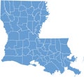
Louisiana State map by counties
Tilted halftone web icon with louisiana state icon
US States - symbolized by the State Capitols Part2
USA State Flag
Hand Drawn Louisiana State Sketch
State of Louisiana. Louisiana State Capitol
Louisiana, state of USA - solid black silhouette map of country area. Simple flat vector illustration
Louisiana, state of USA - solid black outline map of country area. Simple flat vector illustration
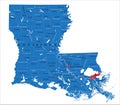
Louisiana state political map
The seal of the state of Louisiana, vintage illustration
Louisiana State Highway road sign
Louisiana LA state Maps. Black silhouette and outline isolated on a white background. EPS Vector
Cajun House and Gator In Louisiana State Map WPA Retro
Louisiana State Map Fleur-de-lis Retro
Doodle vector map of Louisiana state of USA