Search
(+)
cartoon
dealer
buy stock illustrations
Home
My rookie portfolio
📷 Upload yours 🤳
Find results that contain
all
of your keywords. Content filter is
on
. Search will return
best illustrations, stock vectors and clipart
.
Exclude
Make it so!
You have chosen to exclude "
" from your results.
Choose orientation:
Explore cartoons & images using related keywords:
font
text
cartoon
diagram
brand
line
presentation
drawing
poster
advertising
map
screenshot
sketch
document
circle
design
flag
regions
black
white
europe
freedom
emblem
country
red
symbols
travel
maps
european
flags
euro
city
cartograph
geography
love
souvenir
tourism
patriot
draw
cut
republic
countries
outline
silhouette
heritage
patriotism
national
souvenirs
cartography
modern
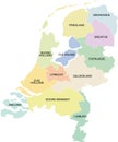
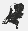
Map Of Netherlands With Regions And Flag Draw And Cut Out Royalty-Free Stock Image
Download
Designed by
Marianrocky
Title
Map of Netherlands with regions and flag draw and cut out #255507898
Description
Map of Netherlands with regions and flag in black and white
Netherlands regions
Netherlands regions map
Netherlands map infographics vector template with regions and pointer marks
Netherlands watercolor map vector illustration of green color with border lines of different regions or provinces on light
all flags of the Netherlands regions
Netherlands map. Cities, regions. Vector
High Quality map of Amsterdam is a city The Netherlands, with borders of the regions. Map of Amsterdam
Netherlands Regions Map
Netherlands map administrative division separate regions with names of individual regions card paper 3D natural
Netherlands regions icons.
Netherlands map, Infographics flat design colors snow white, with names of individual regions
Black map of Netherlands with names of regions, design blackboard
Netherlands Regions Map with Editable Outline Illustration
Netherlands, Holland map with regions isolated on white background.