Search
(+)
cartoon
dealer
buy stock illustrations
Home
My rookie portfolio
📷 Upload yours 🤳
Find results that contain
all
of your keywords. Content filter is
on
. Search will return
best illustrations, stock vectors and clipart
.
Exclude
Make it so!
You have chosen to exclude "
" from your results.
Choose orientation:
Explore cartoons & images using related keywords:
map
drawing
pattern
design
presentation
vector
detailed
state
county
seats
background
zone
city
continent
africa
main
international
airports
ocean
poster
funny
miodern
ice
wall
lillies
countries
country
world
political
south
surrounded
art
custom
printable
print
cityart
gift
sea
nature
abstract
illustrations
clipart
backgrounds
mapping
vektor
svg
jpg
north
mountain
peaks
Central American Continent Illustration With The Highways Royalty-Free Stock Photography
Download
Designed by
Marianrocky
Title
Central American continent Illustration with the Highways #256598183
Description
Central American continent Illustration with the Highways surrounded by the ocean
Road map of the Central American state of Honduras
Vector maps of Central American and Caribbean countries with administrative divisions regions borders
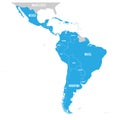
Political map of Latin America. Latin american states blue highlighted in the map of South America, Central America and
Atlas of the 12th century. Map of the Caribbean and Central American zone. Ancient maps were created by craftsmen and produced in
Road map of the Central American state Belize
Central American Steamship Company One Cent Stamp in 1886, vintage illustration
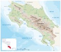
Physical vector map of the Central American Republic of Costa Rica
Vector map of the Central American Republic of Honduras
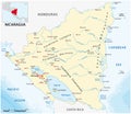
Vector map of the Central American state of Nicaragua
The Central American continent Illustration with Airports
The Central American continent Illustration with railroads
CAFTA as Central American Free Trade Association isolated
The Central American Cacomistle, the ringtail , Bassariscus astutus
Simple map of the Central American state of Panama