Search
(+)
cartoon
dealer
buy stock illustrations
Home
My rookie portfolio
📷 Upload yours 🤳
Find results that contain
all
of your keywords. Content filter is
on
. Search will return
best illustrations, stock vectors and clipart
.
Exclude
Make it so!
You have chosen to exclude "
" from your results.
Choose orientation:
Explore cartoons & images using related keywords:
map
drawing
pattern
design
presentation
vector
detailed
state
county
seats
background
zone
city
continent
international
airports
ocean
poster
countries
country
world
political
south
art
custom
printable
print
cityart
gift
sea
nature
abstract
illustrations
clipart
backgrounds
mapping
vektor
north
mountain
peaks
urban
areas
subregions
rivers
nortth
railroads
ports
oceans
seas
biggest
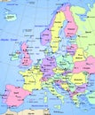
Map Of Europe Continent Illustration With The Capitals Of The Countries Stock Image
Download
Designed by
Marianrocky
Title
Map of Europe continent Illustration with the capitals of the countries #256793155
Description
Map of Europe continent Illustration with the capitals of the countries surrounded by the ocean
Map of europe continent
Hungary Country Abstract 3D Illustrated Map Europe Continent
Africa and europe continent light bulb
Vector Earth globe with zoom up of Europe continent.
Vector Earth globe focused on Europe continent
Cartoon of Man Pointing at Europe Continent on Wall World Map
Cartoon of Man Holding a Sign and Pointing at Europe Continent on Wall World Map
Vector Blue Map of Europe continent
Europe continent is divided by country on Globe
City lights Europe continent at night from outer space. 3D rendering illustration. Earth map texture provided by Nasa. Energy
Flat earth globe isolated. Cartoon world planet with europe continent, america and blue ocean. Ecology concept. Nature geography
Letter E from alphabet with Europe continent
Europe continent highlighted on Earth globe