Search
(+)
cartoon
dealer
buy stock illustrations
Home
My rookie portfolio
📷 Upload yours 🤳
Find results that contain
all
of your keywords. Content filter is
on
. Search will return
best illustrations, stock vectors and clipart
.
Exclude
Make it so!
You have chosen to exclude "
" from your results.
Choose orientation:
Explore cartoons & images using related keywords:
map
planet
earth
world
vector
travel
continent
global
geography
africa
australia
asia
atlas
europe
cartography
north
america
usa
country
south
land
flat
graphic
design
isolated
business
illustration
modern
topography
political
border
west
detailed
style
worldwide
east
sign
digital
detail
surface
World Maps, Continents And Countries Cartoon Vector
Download
Designed by
Sensvector
Title
World maps, continents and countries #267303963
Description
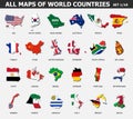
Continents and countries on world maps. Traveling and business, political presentation. Cartography and worldwide. Vector political map in flat style illustration
World Map
Detailed world maps vector
World Globe Maps
Maps of the World by Country Pixel Perfect Icons (line style)
Blue world maps illustration with country borders
Three 3D Globes with World Maps - vector
Maps of the Earth`s. world map, continents, Vector illustration
Antique compass on world map. Vintage geographic history maps with marine compasses arrows vector illustration
Polygonal map. Digital globe map, blue polygons earth maps and world internet connection 3d grid vector concept
Transparent world globe maps planet earth green set
Colored world map. Political maps, colourful world countries and country names vector illustration
Earth set 3D transparent Globes with World Maps - vector
Colored world map. Political map
All maps of world countries and flags . Set 1 of 10 . Collection of outline shape of international country map with shadow . Flat