Search
(+)
cartoon
dealer
buy stock illustrations
Home
My rookie portfolio
📷 Upload yours 🤳
Find results that contain
all
of your keywords. Content filter is
on
. Search will return
best illustrations, stock vectors and clipart
.
Exclude
Make it so!
You have chosen to exclude "
" from your results.
Choose orientation:
Explore cartoons & images using related keywords:
map
administrative
vector
country
geography
illustration
cartography
state
border
region
regional
land
division
political
design
national
nation
area
province
district
detailed
infographic
atlas
boundary
geographical
department
unitary
federal
unit
subdivision
entity
sovereign
divided
local
government
autonomy
autonomous
india
indian
asia
union
teritorry
3d
isometric
isometry
blank
empty
colorful
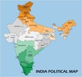
India Political Map Of Administrative Divisions Cartoon Vector
Download
Designed by
Pytyczech
Title
India political map of administrative divisions #269256813
Description
India political map of administrative divisions - states and union teritorries. Isometric 3D blank vector map in four colors scheme.
India Political Map
India political map
Colorful India political map with clearly labeled, separated layers.
India Political Map. Isolated On White. No text
India Political Map. Isolated On White
India Political Map. No roads
India Political Map. No text
India Political Map
India Political Map and Flat Map Icons
India political map divide by state colorful outline simplicity style
Isometric 3D map of India. Political country map in perspective with administrative divisions and pointer marks. Detailed map
Sri Lanka and part of Southern India, political map