Find results that contain all of your keywords. Content filter is on.
Search will return stock photos and royalty free images.
Choose orientation:
Make it so!
You have chosen to exclude "" from your results.
Choose orientation:
Explore cartoons & images using related keywords:
america
map
canada
vector
alaska
hawaii
us
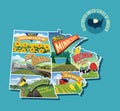
usa north cartography continent nation united state territory province country land geography michigan california florida nevada illinois washington alberta american pennsylvania canadian business projection political graphic administrative states neighborhood neighbor border blue orange yellow colorful color two name labelling labelUnited States And Canada Political Map Vector Illustration
Designed by
Title
United States and Canada political map #273246140
Description


