Search
(+)
cartoon
dealer
buy stock illustrations
Home
Black Friday
Find results that contain
all
of your keywords. Content filter is
on
. Search will return
stock photos and royalty free images
.
Exclude
Make it so!
You have chosen to exclude "
" from your results.
Choose orientation:
Explore cartoons & images using related keywords:
map
idaho
falls
shows
major
interstates
highways
landmarks
nearby
cities
represent
cartography
travel
navigation
tourism
east
technical
college
central
park
canal
tautphaus
snake
river
national
engineering
environmental
laboratory
atomic
city
bingham
county
moreland
rockford
pingree
springfield
fort
hall
blackfoot
firth
basalt
shelley
ammon
lincoln
iona
ucon
rigby
roberts
lewisville
menan
Map Image Of Idaho Falls, Idaho Stock Photography
Download
Designed by
Harperdrewart
Title
Map Image of Idaho Falls, Idaho #274812422
Description
Map Image of Idaho Falls, Idaho. Shows major interstates and highways, landmarks, nearby cities. Could represent cartography, travel, navigation and tourism.
An aerial image of farm fields and grain silos in the Idaho farm fields.
An aerial image of cutting a hay field in Idaho.
Close-up of waving flag of Idaho. Animation. Animated background with blue flag waving in wind with image of state seal
An aerial image of an Idaho dairy farm
An aerial image of Idaho Falls, Idaho with the falls
An aerial image of a farmer cutting and wind rowing alfalfa hay.
2 tractors pulling planting implements in an Idaho farm field.
A woman shows a business card with an image of the Idaho flag
A woman shows a business card with an image of the Idaho flag on wooden background
Map Image of Boise Idaho
Map Image of Idaho Falls, Idaho
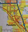
Map Image of Pocatello, Idaho
Map Image of Nampa, Idaho