Search
(+)
cartoon
dealer
buy stock illustrations
Home
My rookie portfolio
📷 Upload yours 🤳
Find results that contain
all
of your keywords. Content filter is
on
. Search will return
best illustrations, stock vectors and clipart
.
Exclude
Make it so!
You have chosen to exclude "
" from your results.
Choose orientation:
Explore cartoons & images using related keywords:
map
oklahoma
city
shows
major
interstates
highways
landmarks
nearby
cities
represent
cartography
travel
navigation
tourism
kingfisher
county
chisolm
trail
museum
seay
mansion
cashion
navina
seward
logan
arcadia
wellston
luther
jones
spencer
choctaw
midwest
newalla
moore
lake
thunderbird
rogers
airport
mustang
tuttle
minco
union
calumet
okarche
reno
yukon
bethany
edmond
village
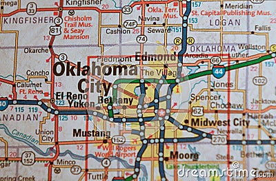
Map Image Of Oklahoma City 1 Royalty-Free Stock Photography
Download
Designed by
Harperdrewart
Title
Map Image of Oklahoma City 1 #275363117
Description
Map Image of Oklahoma City, Oklahoma. Shows major interstates and highways, landmarks, nearby cities. Could represent cartography, travel, navigation and tourism.
Modern high-rise real estate in city center Tulsa including Mayo
Sky dance bridge on I-40 in Oklahoma City, vertical image
Sky dance bridge on I-40 in Oklahoma City, horizontal image
Close-up of waving Oklahoma flag. Animation. Patriotic background flag is rectangular blue color with image in center of
A woman shows a business card with an image of the Oklahoma flag
Toned image a lone dormant tree near small curved paved road in early morning foggy at rural Cartwright, Oklahoma
Oklahoma Flag, USA State Flag Oklahoma, fabric flag Oklahoma, 3D work and 3D image
Map Image of Tulsa Oklahoma \"T-Town\" \"Oil Capital of the World\"
Map Image of Oklahoma City 2
Map Image of Tulsa Oklahoma 2
Map Image of Tulsa Oklahoma 1
Aerial drone photo Oklahoma City