Search
(+)
cartoon
dealer
buy stock illustrations
Home
My rookie portfolio
📷 Upload yours 🤳
Find results that contain
all
of your keywords. Content filter is
on
. Search will return
best illustrations, stock vectors and clipart
.
Exclude
Make it so!
You have chosen to exclude "
" from your results.
Choose orientation:
Explore cartoons & images using related keywords:
earhtquake
topography
technology
background
data
digital
mountain
topographic
terrain
science
surface
wave
cartography
geography
disaster
catastrophe
seismic
topograph
destruction
diagram
earthquake
epicenter
amplitude
magnitude
monitor
plate
shock
tectonic
crack
scale
map
richter
rhythm
scan
frequency
warning
mountains
country
radar
display
victims
litosphere
earth
global
prevention
danger
image
normal
safety
Earthquake Activity Analyzing Digital Display Earth Litosphere Areas Royalty-Free Stock Image
Download
Designed by
Dmglng1
Title
Earthquake activity analyzing digital display earth litosphere areas #275788438
Description
Earthquake activity analyzing digital display tectonic plate areas. Topographic seismic map scannig radar 4k footage. Global disaster prevention
SeismogramSeismic, earthquake activity record. Vector illustration.
Vector earthquake activity round circle red word cloud
Vector earthquake activity round circle
Vector earthquake activity round
Vector earthquake activity hand print stamp
Vector earthquake activity square red
Vector earthquake activity old torn paper word cloud
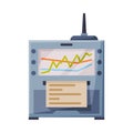
Seismograph or Seismometer, Geodetic Device, Seismic and Earthquake Activity Flat Style Vector Illustration on White
Earthquake activity in urban park flat color vector illustration
Capturing the Tremors, Seismograph Recording Earthquake Activity. Generative Ai