Find results that contain all of your keywords. Content filter is on.
Search will return best illustrations, stock vectors and clipart.
Choose orientation:
Make it so!
You have chosen to exclude "" from your results.
Choose orientation:
Explore cartoons & images using related keywords:
administrative
africa
african
atlas
background
border
boundary
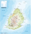
city clip clipping color colored colorful continent contour counties country county creole cut cutout design detail detailed district division element geographically geography illustration indian island isolated location louis map maple mapping mauritian mauritius nation national ocean outline political politically port province region republicMauritius Map Vector Illustration
Designed by
Title
Mauritius map #27706566
Description


