Search
(+)
cartoon
dealer
buy stock illustrations
Home
Black Friday
Find results that contain
all
of your keywords. Content filter is
on
. Search will return
stock photos and royalty free images
.
Exclude
Make it so!
You have chosen to exclude "
" from your results.
Choose orientation:
Explore cartoons & images using related keywords:
africa
african
alexandria
arab
arabic
atlantic
atlas
background
cairo
capital
cartography
city
colored
continent
contour
country
editable
egypt
egyptian
geography
giza
islam
islamic
land
luxor
map
mapping
muslim
national
nile
ocean
outline
pastel
peninsula
political
politics
republic
rivers
road
sea
shaded
sinai
south
suez
territory
topography
town
travel
vector
Egypt - Detailed Editable Political Map. Vector Illustration
Download
Designed by
Pbardocz
Title
Egypt - detailed editable political map. #277381834
Description
Egypt - Highly detailed editable political map.
Infographic for Egypt, detailed map of Egypt with flag
Egypt detailed map highlighted on blue rounded World Map
Egypt detailed skyline. Vector postcard illustration
Cairo Egypt. Detailed Country Map with Location Pin on Capital City.
Egypt - detailed country outline and location on world map.
Egypt - detailed blue country map with cities, regions, location on world map and globe. Infographic icons
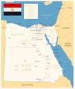
Egypt - detailed map with administrative divisions and country flag. Vector illustration
Egypt - detailed map of the country in brown colors, divided into regions
Map of Giza, Egypt. Detailed city map, metropolitan area border
Map of Port Said, Egypt. Detailed city map, metropolitan area border
Map of Shubra El Kheima, Egypt. Detailed city map, metropolitan area border
Map of Alexandria, Egypt. Detailed city map, metropolitan area border
Map of Suez, Egypt. Detailed city map, metropolitan area border
Egypt - detailed map with administrative divisions country. Vector illustration
Map of El Mahalla El Kubra, Egypt. Detailed city map, metropolitan area border
Egypt - detailed country map with cities and regions. Infographic icons