Search
(+)
cartoon
dealer
buy stock illustrations
Home
My rookie portfolio
📷 Upload yours 🤳
Find results that contain
all
of your keywords. Content filter is
on
. Search will return
stock photos and royalty free images
.
Exclude
Make it so!
You have chosen to exclude "
" from your results.
Choose orientation:
Explore cartoons & images using related keywords:
administrative
american
atlantic
atlas
aurora
background
capital
cartography
chicago
city
colored
continent
contour
country
county
district
editable
geographic
geography
green
illinois
interstate
label
lake
michigan
land
lime
map
mapping
north
ocean
olive
outline
pastel
political
politics
region
rivers
road
shade
shape
springfield
state
territory
topography
travel
united
states
america
usa
Detailed Editable Political Map With Separated Layers. Illinois. Vector Illustration
Download
Designed by
Pbardocz
Title
Detailed editable political map with separated layers. Illinois. #277693768
Description
Highly detailed editable political map with separated layers. Illinois.
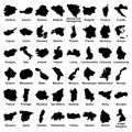
Big vector set of all Europe states, countries on white background. High detailed editable illustration of Europe maps.
Belgium - Highly detailed editable political map with labeling.
Colombia - Highly detailed editable political map with labeling.
Czech Republic - Highly detailed editable political map with labeling.
France - Highly detailed editable political map with labeling.
India - Highly detailed editable political map with labeling.
India - Highly detailed editable political map.
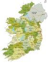
Highly detailed editable political map with separated layers. Ireland.
Israel - Highly detailed, editable political map with labeling.
Highly detailed editable political map with separated layers. Mexico.
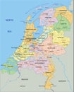
Netherlands - Highly detailed editable political map with separated layers.
Poland - Highly detailed editable political map with labeling.
Romania - Highly detailed editable political map with labeling.
Highly detailed editable political map with separated layers. Russia.
Spain - Highly detailed editable political map with labeling.
Turkey - Highly detailed editable political map with labeling.