Search
(+)
cartoon
dealer
buy stock illustrations
Home
My rookie portfolio
📷 Upload yours 🤳
Find results that contain
all
of your keywords. Content filter is
on
. Search will return
stock photos and royalty free images
.
Exclude
Make it so!
You have chosen to exclude "
" from your results.
Choose orientation:
Explore cartoons & images using related keywords:
sweden
map
europe
european
travel
swedish
white
blue
stockholm
light
background
vector
business
border
world
territories
cartography
geography
country
collection
earth
marker
state
continent
layout
municipalities
political
separation
provinces
tourism
printed
delivery
transportation
contour
division
road
traveling
neighboring
countries
names
illustration
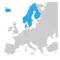
Sweden - Blue Map With Neighboring Countries And Names Stock Illustration
Download
Designed by
Gturik
Title
Sweden - blue map with neighboring countries and names #282613447
Description
Sweden - blue map with neighboring countries and names. Vector illustration
Flag of Sweden
Made in Sweden blue round stamp
Sweden blue square grunge stamp
Scandinavian states Denmark, Norway, Finland, Sweden and Iceland blue highlighted in the political map of Europe. Vector
Sweden blue map silhouette.
Blue world map with magnifying on Sweden
Sweden blue Low Poly map with capital Stockholm
Map icon of Sweden. Blue map of Europe with highlighted Sweden in red color
World map centered on America with magnified Sweden
Stockholm. Name of the capital of Sweden, blue
Sweden map, administrative division with names, white blue card paper 3D blank
Outline Gothenburg Sweden City Skyline with Blue Buildings
National Flag Kingdom of Sweden, blue field charged with a yellow Nordic cross that extends to the edges, the vertical part of the
State flag of Sweden. Blue yellow vector illustration.