Find results that contain all of your keywords. Content filter is on.
Search will return best illustrations, stock vectors and clipart.
Choose orientation:
Make it so!
You have chosen to exclude "" from your results.
Choose orientation:
Explore cartoons & images using related keywords:
wind
belt
central
power
energy
map
united
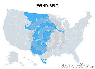
states area electricity resource sustainable renewable green clean farm potential turbine speed high strong region generate land technology america usa american north political country continent americas data stats statistics geography infographic overview mapping atlas blue gray isolated vectorWind Belt Of The United States, Areas With High Wind Speeds, Political Map Vector Illustration
Designed by
Title
Wind Belt of the United States, areas with high wind speeds, political map #288889338
Description


