Search
(+)
cartoon
dealer
buy stock illustrations
Home
Black Friday
Find results that contain
all
of your keywords. Content filter is
on
. Search will return
best illustrations, stock vectors and clipart
.
Exclude
Make it so!
You have chosen to exclude "
" from your results.
Choose orientation:
Explore cartoons & images using related keywords:
map
administrative
vector
country
geography
illustration
cartography
state
border
region
regional
land
division
political
national
nation
area
province
district
detailed
infographic
atlas
boundary
geographical
department
unitary
federal
unit
subdivision
entity
sovereign
divided
local
government
autonomy
autonomous
france
french
europe
provence
blank
empty
brittany
bretagne
breton
rennes
atlantic
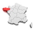
Brittany - Map Of Region Of France Vector Illustration
Download
Designed by
Pytyczech
Title
Brittany - map of region of France #295437678
Description
Brittany - map of administrative division, region, of France. Dark grey vector silhouette.
Flag of Brittany Region, France.
Brittany flag vector
Vector flag of French Brittany region. Brittany province in France flag.
Brittany region of France flag textile cloth fabric waving on the top sunrise mist fog
Map of Brittany region, France
Ham cheese crepe
Brittany region outline map France
Brittany Region of France flag waving on white background, close up, isolated. 3D render
Map of France showing Brittany region. 3D Rendering
Large Flag of Brittany region fullscreen background in the wind
Coat of arms of the Brittany region. France.
Flag of department of Morbihan in the Brittany region, France. 3d rendering
Coat of arms of the Brittany region. France.
map of Brittany region of France
La Vieille Lighthouse. Vector isolated illustration with lettering. Brittany region, France