Search
(+)
cartoon
dealer
buy stock illustrations
Home
My rookie portfolio
📷 Upload yours 🤳
Find results that contain
all
of your keywords. Content filter is
on
. Search will return
best illustrations, stock vectors and clipart
.
Exclude
Make it so!
You have chosen to exclude "
" from your results.
Choose orientation:
Explore cartoons & images using related keywords:
america
atlantic
atlas
border
boundary
bridgeport
capital
cartography
cities
city
coastal
connecticut
map
counties
country
county
fairfield
geographic
geographical
geography
graphic
hartford
litchfield
long
island
sound
mapping
maps
massachusetts
middlesex
england
haven
york
newport
northeast
nutmeg
ocean
political
poughkeepsie
providence
rhode
stamford
state
states
tolland
travel
waterbury
Connecticut Counties Map Stock Photo
Download
Designed by
Griegel
Title
Connecticut counties map #306953346
Description
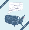
Colorful political map of the state of Connecticut outlining the various counties that make up the region
Connecticut State by counties
Connecticut counties vector map
Connecticut counties map
Connecticut counties icons.
Connecticut county map
County map of Connecticut
Connecticut state counties colored by congressional districts vector map with neighbouring states and terrotories
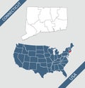
Map of Connecticut state, USA. Set of Connecticut maps with outline border, counties and US states map. Black and white color
Connecticut counties map. Skylines of Hartford, Bridgeport and Stamford
Modern White Map of Connecticut with Counties
Connecticut, U.S. state, subdivided into 8 counties, political map
Connecticut, U.S. state, subdivided into 8 counties, gray political map