Search
(+)
cartoon
dealer
buy stock illustrations
Home
My rookie portfolio
📷 Upload yours 🤳
Find results that contain
all
of your keywords. Content filter is
on
. Search will return
best illustrations, stock vectors and clipart
.
Exclude
Make it so!
You have chosen to exclude "
" from your results.
Choose orientation:
Explore cartoons & images using related keywords:
canada
usa
us
map
vector
illustration
country
cartography
north
america
land
travel
background
continent
alaska
province
state
detail
hawaii
business
infographic
politic
political
administrative
division
geography
location
nation
american
united
graphic
border
atlantic
pacific
isolated
island
contour
transportation
blank
empty
warm
colorful
coloured
yellow
orange
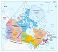
Political Map Of Canada And United States Vector Illustration
Download
Designed by
Pytyczech
Title
Political map of Canada and United States #309104020
Description
Political map of Canada and United States of America with administrative divisions. Colorful map with countries and states name labels. Vector illustration
Canada maps with markers
Illustration of a Administrative and Political Map of Canada
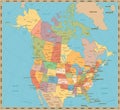
Old vintage color political map of USA and Canada
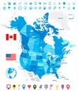
USA and Canada large detailed political map in colors of blue an
Political map of Canada
Administrative and political vector map of the three North American states, Mexico, Canada and the United States of America
Northwest territories political and administrative regions map canada
Highly detailed editable political map with separated layers. Canada.
Political map of Canada
North America, continent, political map of Canada, United States, and Mexico
North America, continent, gray political map of Canada, USA, and Mexico