Search
(+)
cartoon
dealer
buy stock illustrations
Home
My rookie portfolio
📷 Upload yours 🤳
Find results that contain
all
of your keywords. Content filter is
on
. Search will return
stock photos and royalty free images
.
Exclude
Make it so!
You have chosen to exclude "
" from your results.
Choose orientation:
Explore cartoons & images using related keywords:
american
antique
army
atlas
battle
british
campaign
colonies
english
maps
military
old
revolution
siege
vintage
war
Map Of Pennsylvania Stock Photo
Download
Designed by
Cascoly
Title
Map of Pennsylvania #30980538
Description
Map of Pennsylvania and New Jersey from Atlas of the battles of the American Revolution printed in 1845
Pennsylvania(USA) map
Pennsylvania Interstate Map
Philadelphia silhouette, Pennsylvania United States of America States. City Skyline
Pennsylvania State Capitol in Harrisburg
Hand Drawn Pennsylvania State Design
Pennsylvania map - state in the United States of America
Pennsylvania administrative and political vector map
Red sketch map of Pennsylvania
Pennsylvania map silhouette.
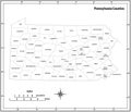
Pennsylvania state outline administrative and political vector map in black and white
Pennsylvania map.
Counties Map of US State of Pennsylvania
Pennsylvania County Map
Pennsylvania PA State Border USA Map Outline