Search
(+)
cartoon
dealer
buy stock illustrations
Home
My rookie portfolio
📷 Upload yours 🤳
Find results that contain
all
of your keywords. Content filter is
on
. Search will return
best illustrations, stock vectors and clipart
.
Exclude
Make it so!
You have chosen to exclude "
" from your results.
Choose orientation:
Explore cartoons & images using related keywords:
usa
united
states
state
county
counties
map
shape
kansas
dickinson
doniphan
douglas
edwards
elk
ellis
ellsworth
finney
ford
franklin
geary
gove
graham
grant
gray
greeley
greenwood
hamilton
harper
harvey
haskell
hodgeman
jackson
jefferson
jewell
johnson
kearny
kingman
kiowa
labette
lane
leavenworth
lincoln
linn
logan
lyon
marion
marshall
mcpherson
meade
miami
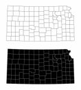
Kansas County Map With 105 Counties Cartoon Vector
Download
Designed by
Vectormaps
Title
Kansas County Map with 105 counties #310670597
Description
US Kansas State Map with 105 counties and county seats. Each county is an individual object.
Vector illustration of a county state with US united states flag
Kansas County Map
Kansas County Map
Kansas County Map
Kansas County Maps
Crawford, Cowley, Edwards, Decatur, Dickinson and Elk County, Kansas U.S. county, United States of America, USA, U.S., US map
Kearny, Kingman, Jackson, Kiowa, Harper and Jewell County, Kansas U.S. county, United States of America, USA, U.S., US map
Lyon, Logan, Lane, Lincoln, Labette and Linn County, Kansas U.S. county, United States of America, USA, U.S., US map vector
Pottawatomie County, Kansas U.S. county, United States of America, USA, U.S., US map vector illustration, scribble sketch
Pratt, Phillips, Pawnee, Osborne, Osage and Ottawa County, Kansas U.S. county, United States of America, USA, U.S., US map
Riley County, Kansas U.S. county, United States of America, USA, U.S., US map vector illustration, scribble sketch Riley map
Pratt, Phillips, Pawnee, Osborne, Osage and Ottawa County, Kansas U.S. county, United States of America, USA, U.S., US map
US Kansas county map
Detailed Kansas County Map at Night A LowLight Photographic Exploration of County Boundaries and Geographic Data