Search
(+)
cartoon
dealer
buy stock illustrations
Home
My rookie portfolio
📷 Upload yours 🤳
Find results that contain
all
of your keywords. Content filter is
on
. Search will return
best illustrations, stock vectors and clipart
.
Exclude
Make it so!
You have chosen to exclude "
" from your results.
Choose orientation:
Explore cartoons & images using related keywords:
suriname
america
south
latin
paramaribo
coronie
sipaliwini
wanica
commewijne
marowijne
brokopondo
saramacca
regions
states
provinces
territories
national
country
map
grey
black
vector
illustration
political
administrative
division
borders
neighbouring
editable
info
infographics
white
background
graphic
detailed
geography
cartography
design
mockup
color
colorful
isolated
physical
information
english
labeled
layers
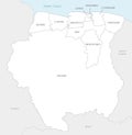
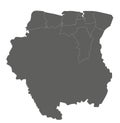
Vector Map Of Suriname With Districts And Administrative Divisions.
Download
Designed by
Antoniosantosg
Title
Vector map of Suriname with districts and administrative divisions. #321006773
Description
Vector map of Suriname with districts and administrative divisions. Editable and clearly labeled layers
Suriname flag vector. Illustration of Suriname flag
Suriname map with administrative divisions.
Suriname officially flag
Polygonal Network Mesh Vector Suriname Map with Coronavirus
Covid Virus Hole Round Suriname Map Mosaic
Stylized neon simple digital isometric striped vector Suriname map, with 3d effect.
Polygonal Network Mesh Vector Suriname Map with Stars
Vector map of Suriname with districts and administrative divisions, and neighbouring countries.
Vector blank map of Suriname with districts and administrative divisions, and neighbouring countries.
Vector map of Suriname with districts and administrative divisions.
Vector blank map of Suriname with districts and administrative divisions.