Search
(+)
cartoon
dealer
buy stock illustrations
Home
My rookie portfolio
📷 Upload yours 🤳
Find results that contain
all
of your keywords. Content filter is
on
. Search will return
best illustrations, stock vectors and clipart
.
Exclude
Make it so!
You have chosen to exclude "
" from your results.
Choose orientation:
Explore cartoons & images using related keywords:
friesland
map
outline
contour
netherlands
silhouette
vector
template
province
boundary
holland
area
provinces
isolated
blank
tourism
shape
region
eps
empty
boundaries
border
design
Friesland Outline Map Cartoon Vector
Download
Designed by
Davidzydd
Title
Friesland outline map #323679369
Description
Friesland province outline map set
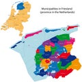
Friesland - province of the Netherlands
Grey silhouette of Netherlands` Holland provinces. Selected administrative division - Friesland
Friesland outline map Holland region Netherlands shape province
Simple outline map of Friesland is a province of Netherlands
Friesland Netherlands outline map
Southwest Friesland municipality (Kingdom of the Netherlands, Holland, Frisia or Friesland province)
Tytsjerksteradiel municipality (Kingdom of the Netherlands, Holland, Frisia or Friesland province)
Waadhoeke municipality (Kingdom of the Netherlands, Holland, Frisia or Friesland province)
Friesland outline map