Search
(+)
cartoon
dealer
buy stock illustrations
Home
My rookie portfolio
📷 Upload yours 🤳
Find results that contain
all
of your keywords. Content filter is
on
. Search will return
best illustrations, stock vectors and clipart
.
Exclude
Make it so!
You have chosen to exclude "
" from your results.
Choose orientation:
Explore cartoons & images using related keywords:
abstract
cartography
chart
country
di
district
federal
isolated
italy
land
map
outline
people
plan
province
provincia
region
state
symbol
taranto
topo
topographic
topography
tourism
travel
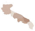
Map Of The Province Taranto (IT). Cartoon Vector
Download
Designed by
Peterkunz
Title
Map of the Province Taranto (IT). #324625699
Description
Symbol Map of the Province Taranto (Italy). showing the state/province with a pattern of randomly distributed colorful squares of different sizes
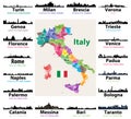
Map of Italy with largest italian cities skylines silhouettes
Italy map with largest italian cities skylines silhouettes vector set
Taranto blank detailed outline map set
Satellite view of the Taranto province, map and streets. Puglia, Italy.
Satellite map of Province of Taranto towns and roads, buildings and connecting roads of surrounding areas. Puglia region, Italy.
Taranto province Italy, Italian Republic, Apulia region map vector illustration, scribble sketch Province of the Ionian map
Puglia map, division by provinces and municipalities. Closed and perfectly editable polygons. Italy
Apulia administrative and political vector map with flag
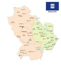
Basilicata administrative and political vector map with flag
Abruzzo administrative and political map with flag
Taranto province Italy, Italian Republic, Apulia region map vector illustration, scribble sketch Province of the Ionian map
Glossy glass flag of Basilicata
Taranto outline map