Search
(+)
cartoon
dealer
buy stock illustrations
Home
Black Friday
Find results that contain
all
of your keywords. Content filter is
on
. Search will return
best illustrations, stock vectors and clipart
.
Exclude
Make it so!
You have chosen to exclude "
" from your results.
Choose orientation:
Explore cartoons & images using related keywords:
ababa
addis
aden
africa
asmara
atlas
bujumbura
burundi
cartography
congo
continent
democratic
djibouti
dodoma
east
eritrea
ethiopia
geography
globe
gulf
hargeisa
hargeysa
horn
illustration
indian
juba
kampala
kenya
khartoum
kigali
kongo
malawi
map
mogadishu
muqdisho
nairobi
ocean
political
politically
red
republic
rwanda
sea
somalia
somaliland
south
sudan
tanzania
uganda
vector
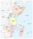
East Africa Political Map Cartoon Vector
Download
Designed by
Peterhermesfurian
Title
East Africa Political Map #32988151
Description
Political map of East Africa with capitals, national borders, rivers and lakes. With english labeling and scale.
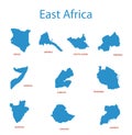
East africa - maps of territories - vector
Map of Europe, North Africa and Middle East, relief map
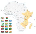
East africa map with flags
Europe Middle East Africa 3D
Detailed vector map of North - Central America, Asia Pacific, Europe, South America, Middle and East Africa Regions
Architecture. East Africa
North Africa and Middle East political map
East Africa region, political map
Physical map of the world, satellite view of the Middle East. Africa, Asia. Globe. Hemisphere. Reliefs and oceans.
East Africa Region. Map of countries in eastern Africa. Vector illustration
East Africa region political map
Detailed air routes on Earth. East Africa. Kenya, Ethiopia, Tanzania. 3D rendering
Political vector map of east africa region
Giraffe in Nairobi National Park Kenya East Africa Art Deco WPA Poster Art