Search
(+)
cartoon
dealer
buy stock illustrations
Home
Black Friday
Find results that contain
all
of your keywords. Content filter is
on
. Search will return
best illustrations, stock vectors and clipart
.
Exclude
Make it so!
You have chosen to exclude "
" from your results.
Choose orientation:
Explore cartoons & images using related keywords:
administrative
alberta
america
baffin
banks
boston
british
brunswick
canada
cartography
columbia
country
dawson
denmark
edward
elizabeth
ellesmere
geography
greenland
halifax
iceland
illustration
inuvik
island
islands
manitoba
map
montreal
new
newfoundland
northwest
nova
nunavut
ontario
ottawa
prince
quebec
queen
resolute
reykjavik
saskatchewan
scotia
silhouette
states
territories
territory
united
vancouver
vector
victoria
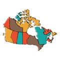
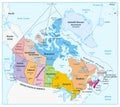
Political Map Of Canada Cartoon Vector
Download
Designed by
Bogdanserban
Title
Political map of Canada #33130577
Description
Highly detailed vector map of Canada with administrative regions, main cities and roads.
Canada maps with markers
Illustration of a Administrative and Political Map of Canada
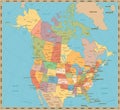
Old vintage color political map of USA and Canada
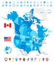
USA and Canada large detailed political map in colors of blue an
Political map of Canada
Administrative and political vector map of the three North American states, Mexico, Canada and the United States of America
Northwest territories political and administrative regions map canada
Highly detailed editable political map with separated layers. Canada.
Political map of Canada
Political map of Canada and United States
North America, continent, political map of Canada, United States, and Mexico
North America, continent, gray political map of Canada, USA, and Mexico