Search
(+)
cartoon
dealer
buy stock illustrations
Home
My rookie portfolio
📷 Upload yours 🤳
Find results that contain
all
of your keywords. Content filter is
on
. Search will return
best illustrations, stock vectors and clipart
.
Exclude
Make it so!
You have chosen to exclude "
" from your results.
Choose orientation:
Explore cartoons & images using related keywords:
mapping
territory
world
map
banner
location
capital
countries
ocean
concept
globes
infographic
nation
shape
international
color
globe
modern
detailed
sign
political
north
flat
design
business
asia
topography
icon
national
state
abstract
symbol
region
outline
global
white
america
europe
earth
background
atlas
land
border
isolated
continent
travel
geography
cartography
country
polandia
Persia Country Map And Major Cities Around It On Physical Map Royalty-Free Stock Photo
Download
Designed by
Jummindfreak41
Title
persia country map and major cities around it on physical map #332505675
Description
Closeup of persia country map and major cities around it on physical map
Country road in mountains
Persepolis-ancient capital of Persians, Iran, Persia
Islamic Republic of Iran - Persia
Aerial view fof desolate desert near Yazd. Persia, Iran
The old abandoned Iranian village located in the central part of the country
Vintage 1930s map of Mountainous Afghanistan.
Geographical map location of Middle East country in Asia continent on atlas
European Union or EU and Iran national flag from textile. Symbol of the Council of Europe association
Turkey and Iran or Persia, symbol of country. Turkish vs Iranian national flag
Ukraine and Iran or Persia, symbol of country. Ukrainian vs Iranian national flags
Iran globe map close-up.
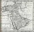
Antique map of Persia,Turkey in Asia and Arabia
A man getting under arrest in Iran or Persia. Concept of being handcuffed, detained, incarcerated and jailed in said country.