Search
(+)
cartoon
dealer
buy stock illustrations
Home
Black Friday
Find results that contain
all
of your keywords. Content filter is
on
. Search will return
stock photos and royalty free images
.
Exclude
Make it so!
You have chosen to exclude "
" from your results.
Choose orientation:
Explore cartoons & images using related keywords:
lawrence
island
bering
sea
ile
southampton
saintlaurent
isla
lorenzo
united
states
north
america
usa
openstreet
osm
humanitarian
map
territory
region
country
continent
shape
outline
earth
planet
atlas
border
geography
stereographic
land
nature
ocean
science
contour
world
zoom
St. Lawrence Island. United States. Topo Humanitarian Royalty-Free Stock Photography
Download
Designed by
Zelwanka
Title
St. Lawrence Island. United States. Topo Humanitarian #333373889
Description
St. Lawrence Island in the Bering Sea on a topographic, OSM Humanitarian style map
Prince Edward Island vector road map
Vintage map of Newfoundland 1900s
St. Lawrence island United States of America, North America, Alaska, US, USA, Bering Sea map vector illustration, scribble
Prince Edward Island, Maritime province of Canada, political map
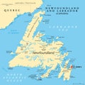
Island of Newfoundland, political map, part of Newfoundland and Labrador
Prince Edward Island, Maritime province of Canada, gray political map
Cavendish Beach on Prince Edward Island National Park Canada WPA Poster Art
Thousand Islands National Park on the Saint Lawrence River Canada WPA Poster Art
Photo Archive of a City of Montreal tanker truck
Vector road map of Cape Breton Island, Nova Scotia, Canada
Vector map of the Gulf of Saint Lawrence, Canada, United states