Search
(+)
cartoon
dealer
buy stock illustrations
Home
My rookie portfolio
📷 Upload yours 🤳
Find results that contain
all
of your keywords. Content filter is
on
. Search will return
best illustrations, stock vectors and clipart
.
Exclude
Make it so!
You have chosen to exclude "
" from your results.
Choose orientation:
Explore cartoons & images using related keywords:
aerial
aerospace
area
australian
backgrounds
border
cartographer
cartography
coastline
computer
country
culture
cultures
desert
design
destinations
dividing
drawing
earth
element
equipment
equirectangular
ethnicity
feature
forest
frame
geographic
geographical
geography
global
globe
graphic
industry
information
island
land
map
material
navigational
no
ocean
oceania
pacific
panorama
pattern
people
physical
planet
positioning
relief
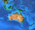
Satellite Map Of Oceania, World Map Royalty-Free Stock Photo
Download
Designed by
Zirui08
Title
Satellite map of Oceania, world map #333566487
Description
The world map is made with Natural Earth 1 Oceania only, Added Enhanced display of land mountainous terrain.
3D earthï¼Ëterrainï¼â°oceania
Australasia Oceania - High resolution map
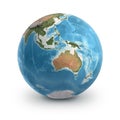
Physical map of the world, satellite view of Australia. Oceania. Globe. Hemisphere. Reliefs and oceans.
Physical map of the world, satellite view of the Middle East. Africa, Asia. Globe. Hemisphere. Reliefs and oceans.
Physical map of the world, satellite view of Australia. Oceania. Globe. Hemisphere. Reliefs and oceans
Planet Earth globe. Australia, Oceania and Southeast Asia
Satellite view of Australia and Oceania
Arundel Island. Solomon Islands. Shape on white. Satellite, March 8, 2024
Beqa Island. Fiji. Shape on white. Satellite, May 20, 2024
Bora Bora Island. France. Shape on white. Satellite, April 4, 2024
Bora Bora Island, France, cropped to square. Satellite, April 4, 2024
Arundel Island. Solomon Islands. Satellite, March 8, 2024
Yasawa Island. Fiji. Satellite, May 20, 2024
Gagil-Tomil Island. Micronesia. Shape on white. Satellite, March 6, 2024