Search
(+)
cartoon
dealer
buy stock illustrations
Home
My rookie portfolio
📷 Upload yours 🤳
Find results that contain
all
of your keywords. Content filter is
on
. Search will return
best illustrations, stock vectors and clipart
.
Exclude
Make it so!
You have chosen to exclude "
" from your results.
Choose orientation:
Explore cartoons & images using related keywords:
brindisi
map
vector
outline
atlas
blank
silhouette
empty
eps
boundary
geography
territory
design
isolated
contour
area
shape
tourism
boundaries
apulia
borders
detailed
region
Brindisi Outline Map Cartoon Vector
Download
Designed by
Davidzydd
Title
Brindisi outline map #334660667
Description
Brindisi province outline map set
Brindisi blank detailed outline map set
Militar antique building linear icon. Modern outline Militar ant
Satellite map of Province of Brindisi towns and roads, buildings and connecting roads of surrounding areas. Puglia region, Italy
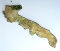
Satellite view of the Puglia region. Italy.
Monument to Italian Sailors, Brindisi, Italy
Brindisi province Italy, Italian Republic, Apulia region map vector illustration, scribble sketch Province of Brindisi map
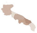
Puglia map, division by provinces and municipalities. Closed and perfectly editable polygons. Italy
Brindisi province Italy, Italian Republic, Apulia region map vector illustration, scribble sketch Province of Brindisi map
Vector Brindisi, southern Italy, postcard. Old residential buildings, palm trees on a hot summer day. Region of Apulia. Italian
Brindisi Italy outline map
Brindisi Italy silhouette map with transparent background
Map of the Province Brindisi (IT).