Search
(+)
cartoon
dealer
buy stock illustrations
Home
My rookie portfolio
📷 Upload yours 🤳
Find results that contain
all
of your keywords. Content filter is
on
. Search will return
best illustrations, stock vectors and clipart
.
Exclude
Make it so!
You have chosen to exclude "
" from your results.
Choose orientation:
Explore cartoons & images using related keywords:
belgium
border
cartography
country
diplomacy
embassy
europe
european
geography
icon
illustration
international
map
nation
national
netherlands
politics
province
regions
republics
sign
state
symbol
tourism
travel
Map Of Belgium And The Netherlands. Royalty-Free Stock Image
Download
Designed by
Tatiana53
Title
Map of Belgium and the Netherlands. #35091304
Description
Map of Belgium and the Netherlands. 3d
Benelux states Belgium, Netherlands and Luxembourg pink highlighted in the political map of Europe. Vector illustration
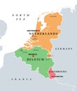
Benelux. Belgium, Netherlands and Luxembourg, political map
Belgium, Netherlands, Czech Republic, Slovakia flag location map pin icon
Benelux grunge flag, politico-economic union of Belgium, Netherlands, Luxembourg
Benelux, Belgium, Netherlands and Luxembourg, single states, political map
Vector regions map of Belgium, Netherlands and Luxembourg. Amsterdam, Brussels and Luxembourg City flat style skylines
Vector regions map of Benelux countries: Belgium, Netherlands and Luxembourg, with neighbouring countries and territories
Skylines illustrations of Brussels, Amsterdam, Luxembourg City. Flags of Benelux countries: Belgium, Netherlands, Luxembourg. Vect
Benelux smoke flag, politico-economic union of Belgium, Netherlands, Luxembourg
Netherlands and Belgium two flags textile cloth 3D rendering
Round flags of Bulgaria, Belgium, Netherlands, Luxembourg. Pin buttons.
High quality political map of Belgium, Netherlands and Luxembour
Western Europe map. United Kingdom, France, Poland, Ireland, Denmark, Belgium, Netherlands maps with regions.
Benelux Union member states, Belgium, Netherlands, Luxembourg, political map