Search
(+)
cartoon
dealer
buy stock illustrations
Home
My rookie portfolio
📷 Upload yours 🤳
Find results that contain
all
of your keywords. Content filter is
on
. Search will return
best illustrations, stock vectors and clipart
.
Exclude
Make it so!
You have chosen to exclude "
" from your results.
Choose orientation:
Explore cartoons & images using related keywords:
us
usa
united
states
sky
clouds
relief
shaded
hillshade
state
massachusetts
america
map
federal
province
region
country
travel
tourism
vacation
terrain
topographic
topo
topography
geography
boundaries
administrative
territory
nature
earth
river
lake
planet
natural
science
cartography
land
representation
bathymetry
digital
ocean
seafloor
creative
design
nobody
no
people
Map Of The State Massachusetts (US). Stock Photography
Download
Designed by
Peterkunz
Title
Map of the State Massachusetts (US). #355194710
Description
Map of the State Massachusetts (United States of America) showing the state with relief representation, water bodies like seas, rivers, lakes and with borders. No labels.
Map of Nantucket Iceland in the US state of Massachusetts
Map of the U.S. state Massachusetts
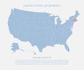
State Massachusetts on USA territory map. White background. Vector illustration
Massachusetts, state of USA - solid black silhouette map of country area. Simple flat vector illustration
Dotted Pattern Map of US State of Massachusetts
Gray Map of the USA State of Massachusetts
United states America, state Massachusetts USA map
Massachusetts MA State Border USA Map Outline
Abstract square stamp or sign with name of US state Massachusetts
Road map of the US American State of Massachusetts
Stylized map of the U.S. state of Massachusetts vector illustration
Stylized map of the U.S. State of Massachusetts vector illustration