Search
(+)
cartoon
dealer
buy stock illustrations
Home
My rookie portfolio
📷 Upload yours 🤳
Find results that contain
all
of your keywords. Content filter is
on
. Search will return
best illustrations, stock vectors and clipart
.
Exclude
Make it so!
You have chosen to exclude "
" from your results.
Choose orientation:
Explore cartoons & images using related keywords:
fayetteville
map
us
cartography
state
district
jonesboro
election
ozarks
usa
texarkana
federal
geography
conway
border
county
america
topography
boundary
diagram
administrative
graphic
democracy
united
land
political
subdivision
chart
local
government
north
location
silhouette
isolated
shape
american
solid
atlas
system
detailed
blank
black
outline
thin
Administrative Map Of Arkansas, AR Royalty-Free Illustration
Download
Designed by
Pytyczech
Title
Administrative Map of Arkansas, AR #363452310
Description
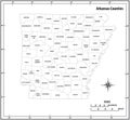
Arkansas, AR - detailed political map of US state. Administrative map divided into counties. Thin blank black outline map. Vector illustration
Arkansas counties vector map
Arkansas state outline administrative and political map in black and white
Arkansas Map. State and district map of Arkansas. Administrative and political map of Arkansas with names and color design
Arkansas Map. State and district map of Arkansas. Administrative and political map of Arkansas with the major district
Illustration a large detailed administrative Map of the US American State Arkansas
Little Rock map, capital city of the USA state of Arkansas. Municipal administrative area map with rivers and roads, parks and
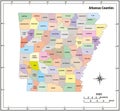
Arkansas state outline administrative and political vector map in color
Administrative map of Central Arkansas, Little Rock Metro, Arkansas, United States
Little Rock city map, capital of the USA state of Arkansas. Municipal administrative black and white area map with rivers and
Administrative Map of Arkansas, AR