Search
(+)
cartoon
dealer
buy stock illustrations
Home
My rookie portfolio
📷 Upload yours 🤳
Find results that contain
all
of your keywords. Content filter is
on
. Search will return
best illustrations, stock vectors and clipart
.
Exclude
Make it so!
You have chosen to exclude "
" from your results.
Choose orientation:
Explore cartoons & images using related keywords:
africa
backgrounds
business
buttons
capitals
cartography
color
colorful
communication
countries
country
digital
earth
east
egypt
elements
european
flag
generated
geographic
geography
global
globe
graphic
greece
hemisphere
icon
illustration
land
language
location
map
modern
nigeria
north
ocean
official
planet
politic
political
science
silhouette
south
state
sudan
travel
union
vector
world
worldwide
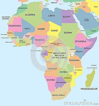
Coloured Political Map Of Africa Cartoon Vector
Download
Designed by
Max776
Title
Coloured political map of Africa #36633579
Description
Colored political map of africa
Italy map
Coloured political map of Asia
Coloured political map of Europe
Coloured political map of North and South America
Coloured political map of the world vector
Old 1945 Map of the political and principal railway system of Ireland
Multi-colored blank political map of World with national borders of countries on white background
Map of United Kingdom coloured with Union Jack Flag
Colored world map. Political map
USA political map. Color vector map with state borders
Colorful political map of World
Colored world map. Political maps, colourful world countries and country names.
Political map of North America
USA map with divided States. Vector political map with capital cities in 3D style. Infographic set with United States of America