Find results that contain all of your keywords. Content filter is on.
Search will return best illustrations, stock vectors and clipart.
Choose orientation:
Make it so!
You have chosen to exclude "" from your results.
Choose orientation:
Explore cartoons & images using related keywords:
cotswold
united
kingdom
europe
cirencester
charlton
kings
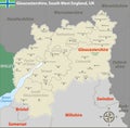
cheltenham bishop 039 cleeve churchdown tewkesbury evesham stroud gloucester pershore royal wootton bassett stonehouse highworth swindon carterton dursley malvern witney ledbury yate administrative boundaries region country location territory earth planet atlas border divisions geography geographic map cartography visualization nature educational science zoomCotswold, United Kingdom. OpenStreetMap Humanitarian Royalty-Free Stock Image
Designed by
Title
Cotswold, United Kingdom. OpenStreetMap Humanitarian #374430466
Description


