Search
(+)
cartoon
dealer
buy stock illustrations
Home
My rookie portfolio
📷 Upload yours 🤳
Find results that contain
all
of your keywords. Content filter is
on
. Search will return
best illustrations, stock vectors and clipart
.
Exclude
Make it so!
You have chosen to exclude "
" from your results.
Choose orientation:
Explore cartoons & images using related keywords:
administrative
antigua
area
bahamas
barbados
barbuda
boundary
caribbean
cayman
contour
country
cuba
division
dominica
geography
grenada
haiti
illustration
island
jamaica
map
nation
political
puerto
region
rico
state
tobago
trinidad
Political Map Of Caribbean Vector Illustration
Download
Designed by
Sateda
Title
Political map of Caribbean #41603488
Description
Vector political maps with flags of Caribbean on white background
Central America map - green hue colored on dark background. High detailed political map Central American and Caribbean
Central America map - white lands and grey water. High detailed political map Central American and Caribbean region with
Political Caribbean and Central America Map vector illustration with different colors for each country
Political Caribbean and Central America Map vector illustration with countries in white color
Political Caribbean and Central America Map vector illustration isolated in white background
Bonaire, Netherlands, political map, Leeward Antilles island in the Caribbean Sea
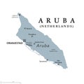
Aruba, gray political map, island in the Leeward Antilles in the Caribbean Sea
Windward Islands, political map, islands of Lesser Antilles in the Caribbean
Leeward Islands, political map, part of Lesser Antilles in the Caribbean
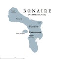
Bonaire, Netherlands, gray political map, island in the Caribbean
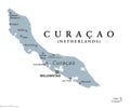
Curacao, gray political map, Caribbean island in the Leeward Antilles
Windward Islands, gray political map, islands in the Caribbean Sea
Leeward Islands, gray political map, islands in the Caribbean Sea
Blank Political Caribbean and Central America Map vector illustration with countries in white color.
Blank Political Caribbean and Central America Map vector illustration with different colors for each country.
Blank Political Caribbean and Central America Map vector illustration isolated in white background.