Search
(+)
cartoon
dealer
buy stock illustrations
Home
My rookie portfolio
📷 Upload yours 🤳
Find results that contain
all
of your keywords. Content filter is
on
. Search will return
best illustrations, stock vectors and clipart
.
Exclude
Make it so!
You have chosen to exclude "
" from your results.
Choose orientation:
Explore cartoons & images using related keywords:
andorra
background
border
cartography
city
continent
country
design
euro
europe
european
geographical
geography
global
graphic
graphically
grey
illustration
labels
liechtenstein
location
map
mini
ministates
monaco
names
nation
national
political
politics
representation
silhouette
simple
simplified
states
united
vatican
vector
wallpaper
Political Map Of Europe Cartoon Vector
Download
Designed by
Pytyczech
Title
Political map of Europe #47277815
Description
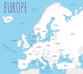
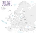
Political map of Europe with state codes and names, vector illustration
Political blank map of Europe in white background.
Political Europe Map vector illustration.
Political Physical Topographic Colored World Map Pacific Centered
Political Europe brown map with state borders, illustration
Political europe map, illustration
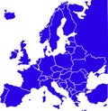
Blue colored European states map. Political europe map
Belarus highlighted on european map. Belarusian state marked on political europe map
Political Europe Map vector illustration with different colors for each country
Political Europe Map vector illustration with countries in white color
Political Europe Map vector illustration isolated in white background
Red colored European states map. Political europe map
Political Europe Map vector illustration isolated on white background with country names in spanish.
Political Europe Map vector illustration isolated on white background.
Blank Political Europe Map vector illustration with countries in white color.