Search
(+)
cartoon
dealer
buy stock illustrations
Home
My rookie portfolio
📷 Upload yours 🤳
Find results that contain
all
of your keywords. Content filter is
on
. Search will return
best illustrations, stock vectors and clipart
.
Exclude
Make it so!
You have chosen to exclude "
" from your results.
Choose orientation:
Explore cartoons & images using related keywords:
america
argentina
atlas
background
black
brazil
business
canada
city
continent
country
earth
geography
global
illustration
map
maps
mexico
north
political
south
travel
usa
white
world
North And South America Maps Cartoon Vector
Download
Designed by
Liorpt
Title
North and South America maps #50178213
Description
North and South America vector maps
North and South America map vector, illustration
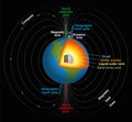
Earths Magnetic Field
North and South America high detailed vector political map
Tennessee - North Carolina - Alabama - Georgia - South Carolina
Wind rose with the designation of North, South, West and East, v
Political map of Americas in grey on white background. North and South America with country labels. Simple flat vector
The Americas, North and South America, political map
Political map of Americas in four colors on white background. North and South America with country labels. Simple flat
Compass with north south east west
Map of World. Political map divided to six continents - North America, South America, Africa, Europe, Asia and Australia
Blank Blue similar North and South America map isolated on white background. Vector template for web
North Carolina and South Carolina, United States
Planet Earth, globe vector linear picture. Outline. North and South America. Central America. The Atlantic Ocean and the Pacific O
Vector compass rose with North, South, East and West indicated
Four cardinal directions, or cardinal points. Compass rose with North, South, East and West indicated, Stock Vector illustration