Search
(+)
cartoon
dealer
buy stock illustrations
Home
My rookie portfolio
📷 Upload yours 🤳
Find results that contain
all
of your keywords. Content filter is
on
. Search will return
best illustrations, stock vectors and clipart
.
Exclude
Make it so!
You have chosen to exclude "
" from your results.
Choose orientation:
Explore cartoons & images using related keywords:
austria
background
belgium
border
borders
britain
bulgaria
cartography
color
continent
countries
country
croatia
czechia
denmark
earth
europe
finland
france
geography
germany
great
greece
hungary
illustration
island
italy
land
learning
mainland
map
national
netherlands
norway
ocean
poland
political
politics
portugal
region
republic
romania
russia
science
serbia
slovakia
spain
state
sweden
switzerland
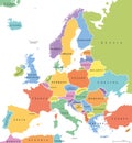
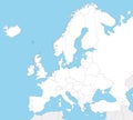
Political Map Of Europe Vector Illustration
Download
Designed by
Roman170976
Title
Political map of Europe #60710846
Description
Color political map of Europe with borders of countries
Europe single states political map
Political blank map of Europe in white background.
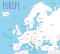
Political Europe Map vector illustration.
Political Physical Topographic Colored World Map Pacific Centered
Political Europe brown map with state borders, illustration
Political europe map, illustration
Blue colored European states map. Political europe map
Belarus highlighted on european map. Belarusian state marked on political europe map
Political Europe Map vector illustration with different colors for each country
Political Europe Map vector illustration with countries in white color
Political Europe Map vector illustration isolated in white background
Political Europe Map vector illustration isolated on white background with country names in spanish.
Political Europe Map vector illustration isolated on white background.
Blank Political Europe Map vector illustration with countries in white color.
Blank Political Europe Map vector illustration with different colors for each country.
Political Europe Map vector illustration isolated in white background.