Search
(+)
cartoon
dealer
buy stock illustrations
Home
My rookie portfolio
📷 Upload yours 🤳
Find results that contain
all
of your keywords. Content filter is
on
. Search will return
best illustrations, stock vectors and clipart
.
Exclude
Make it so!
You have chosen to exclude "
" from your results.
Choose orientation:
Explore cartoons & images using related keywords:
administrative
areas
atlas
country
danzig
district
districts
europe
european
geographic
geography
illustration
kingdom
land
map
mapper
mapping
nation
plan
poland
poles
polish
political
province
red
region
regions
scale
silhouette
state
vector
warsaw
warszawa
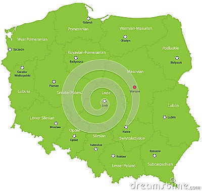
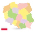
Poland Vector Illustration
Download
Designed by
Indos82
Title
Poland #6305134
Description
Poland map designed in illustration with the 16 provinces colored in green colors and with the main cities. Neighbouring countries are in an additional format (.AI) in the latent layer.
Poland map with shadow
POLAND MAP
Poland map
Poland map and cities
Silhouette of Warsaw in Poland
Map of Poland
Map of Poland
Poland Political Map
Poland map vector
Poland map card paper 3D natural
Poland map vector with red pin
Poland Map and Poland location on the Europe map isolated on transparent background
Poland Map and Colored Icons
Poland Map Isolated on white. No text
Palace of Culture and Science Warsaw, Poland. Isolated on white background vector illustration