Search
(+)
cartoon
dealer
buy stock illustrations
Home
Black Friday
Find results that contain
all
of your keywords. Content filter is
on
. Search will return
best illustrations, stock vectors and clipart
.
Exclude
Make it so!
You have chosen to exclude "
" from your results.
Choose orientation:
Explore cartoons & images using related keywords:
alappuzha
blank
border
borders
boundary
calicut
capital
color
colorful
colorfully
colour
colourful
country
district
eranakulam
gods
idukki
illustrated
illustration
india
indian
kannur
kasargod
kerala
kollam
kottayam
kozhikkode
line
list
malabar
malappuram
map
names
numbers
own
palakkad
pathanamthitta
province
provinces
south
southern
state
states
thiruvanandapuram
trissur
white
wynad
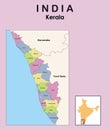
Map Of Kerala With Districts Stock Photography
Download
Designed by
Thayyilani
Title
Map of Kerala with Districts #6530012
Description
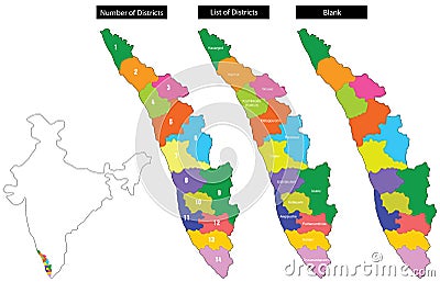
An useful map of Kerala state, India, with district numbers, district borders and district names.
Map of Kerala
Detailed Map of Kerala
Modern Map - Kerala IN India federal state illustration
Kerala map with Indian national flag illustration
Administrative and political map of indian state of kerala, india
Kerala map with districts highlighted
Kerala in India map. Kerala Map vector illustration
Kerala map with borders vector illustration. Kerala map
Kerala map. vector illustration of district map of Kerala in white colour
Kerala map. vector illustration of colourful district map of Kerala with borders
Kerala map. vector illustration of district map of Kerala with outline border
Kerala district map in colorful design vector illustration
Map of India with neighbouring countries and territories. Indian map colored by states and showing districts boundaries inside eac
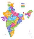
India high detailed vector map showing states and districts boundaries with states` names and capitals. Flag of India