Search
(+)
cartoon
dealer
buy stock illustrations
Home
My rookie portfolio
📷 Upload yours 🤳
Find results that contain
all
of your keywords. Content filter is
on
. Search will return
best illustrations, stock vectors and clipart
.
Exclude
Make it so!
You have chosen to exclude "
" from your results.
Choose orientation:
Explore cartoons & images using related keywords:
administration
background
border
color
colorful
country
departement
department
design
france
french
geographic
illustration
map
merged
national
new
paris
political
region
regional
regions
tourism
travel
vector
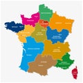
New Regions Of France, Map Royalty-Free Stock Image
Download
Designed by
Lesniewski
Title
New regions of france, map #67328692
Description
The new regions of france since map
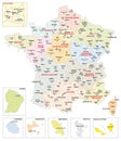
Administrative map of the 13 regions of france since 2016
New regions of France - final version
Administrative map of the 13 regions of France and overseas territories
13 new regions of France reformed - colored editable illustration
SAINT-TROPEZ is a town on the French Riviera , `Côte d`Azur`is one of the 18 administrative regions of France.
Detailed color vector map of 13 regions of France from 2016 with location on maps of the world and Europe
Detailed vector map of regions of France with flag
Map of overseas departments and regions of France. High detailed vector outline and blue silhouette. France flag. English labeling
all Flags of regions of France template for your design
Flag of Brittany (Regions of France, French Republic)
Flag of Centre-Val de Loire (Regions of France, French Republic) Centre Region
Flag of Collectivity of Corsica (Regions of France, French Republic) A white field with a black Moor\'s head
Flag of Occitania (Regions of France, French Republic