Search
(+)
cartoon
dealer
buy stock illustrations
Home
My rookie portfolio
📷 Upload yours 🤳
Find results that contain
all
of your keywords. Content filter is
on
. Search will return
best illustrations, stock vectors and clipart
.
Exclude
Make it so!
You have chosen to exclude "
" from your results.
Choose orientation:
Explore cartoons & images using related keywords:
archipelago
atlas
contour
crete
cyclades
detail
detailed
district
enclosed
euboea
european
geographically
geography
greece
greek
illustration
location
map
maple
physical
political
rhodes
silhouette
sporades
territory
travel
turkey
Aegean Sea Map Vector Illustration
Download
Designed by
Volina
Title
Aegean Sea map #70462976
Description
The Aegean Sea is an elongated embayment of the Mediterranean Sea located between the Greek and Anatolian peninsulas, i.e., between the mainlands of Greece and Turkey.
Aegean Sea
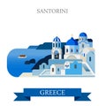
Santorini Aegean Sea Islands Greece flat vector attraction sight
Aegean sea sign or stamp
Map of The GREEK Lands: Greece, Peloponnese, Thrace, Macedonia, Balkans, Aegean Sea. Geographic chart.
Vector map of the Santorini archipelago in the South Aegean Sea, Greece
Oia town on Santorini island, Greece. Aegean sea
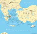
Aegean Sea region, with Aegean Islands, political map
Aegean Sea region, with Aegean Islands, gray political map
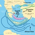
Aegean Sea Plate, also known as Aegean or Hellenic Plate, tectonic map
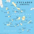
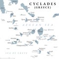
Cyclades, group of Greek islands in the Aegean Sea, political map
Cyclades, group of Greek islands in the Aegean Sea, gray political map
North Aegean outline map
South Aegean outline map
Syros, Greek island in the Aegean Sea, political map
Syros, Greek island in the Aegean Sea, gray political map